Geotagging: Do More with your Images and Videos
GPS (Global Positioning System) refers to a system of satellites in earth orbit, which transmit signals to devices on the ground. GPS devices detect these signals and use them to triangulate their position, heading, speed, altitude and other information. This location information can be embedded in an image to show the photographer where the camera was when the photo was taken.
Select Nikon COOLPIX digital cameras have built-in GPS, while other cameras, such as the Nikon 1 V series digital cameras and certain Nikon D-SLRs can utilize optional accessory GPS devices. The Nikon 1 V series cameras use the GP-N100 unit and compatible Nikon D-SLRs are use the GP-1. Check your manual to see if your specific camera supports GPS functionality.
Recording GPS data can be useful for the travel photographer who is always shooting on location, to be able to go into the image metadata and see exactly where an image was captured. Some photographers like to keep track of their travels on a world map; and some websites and programs incorporate maps that let you view or categorize your photos by GPS location. This is known as geotagging.
Geotagging is great for photographers who like to share with fellow photographic enthusiasts exactly where they captured a specific image, so others can find that spot and make their own images of the same subject. We also know a few photographers who like to keep their favorite shooting spots a secret and won't divulge the GPS coordinates of these locations!
One caveat to posting digital images that have GPS information on websites is that anyone can see where your photograph(s) were taken, so if you don’t want people to know exactly where on the globe your house can be found, make sure the GPS information is not in the image’s metadata when sharing via email or posting on the internet.
Geolocation
Many Nikon COOLPIX cameras that incorporates GPS also feature an Electronic Compass, maps and Points of Interest (POI) information, which make these cameras an ideal choice for the intrepid traveler. So, not only can you record where you’ve been with the GPS feature, but the Points of Interest can show you what landmarks are nearby at any time, and you can even track and log your daily travels using the Maps feature. Not sure if you’re lost… the Electronic Compass may be able to put you back on course.
Using your COOLPIX camera's GPS feature is easy to use once you’ve set the correct date and time on the camera. (You can even set the camera to “synchronize” the exact time with the satellites.) To triangulate your location, the camera needs to access a minimum of three satellites. The camera’s LCD will display the number of satellites that the camera is receiving data from. If three or four satellites are accessible by the camera, it can record the position information onto the image file.
When traveling outside of the U.S. with plans to use a GPS device incorporated in your camera or as an accessory, check with the country you plan to visit to see if there are limitations to use, as certain countries prohibit the use of GPS recording equipment within their borders.
Many COOLPIX cameras with GPS functionality as well as the GP-N100 GPS unit for the Nikon 1 are compatible with A.GPS, which stands for Assist GPS file; which can shorten the time it takes for your camera’s GPS to locate your position. The latest A.GPS file can be downloaded from the website http://nikonimglib.com/agps/index.html. Follow the instructions in your camera’s manual to upload the file to the camera’s internal memory.
Viewing Geotagged Images
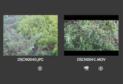
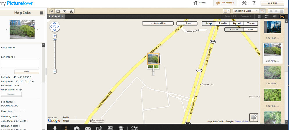
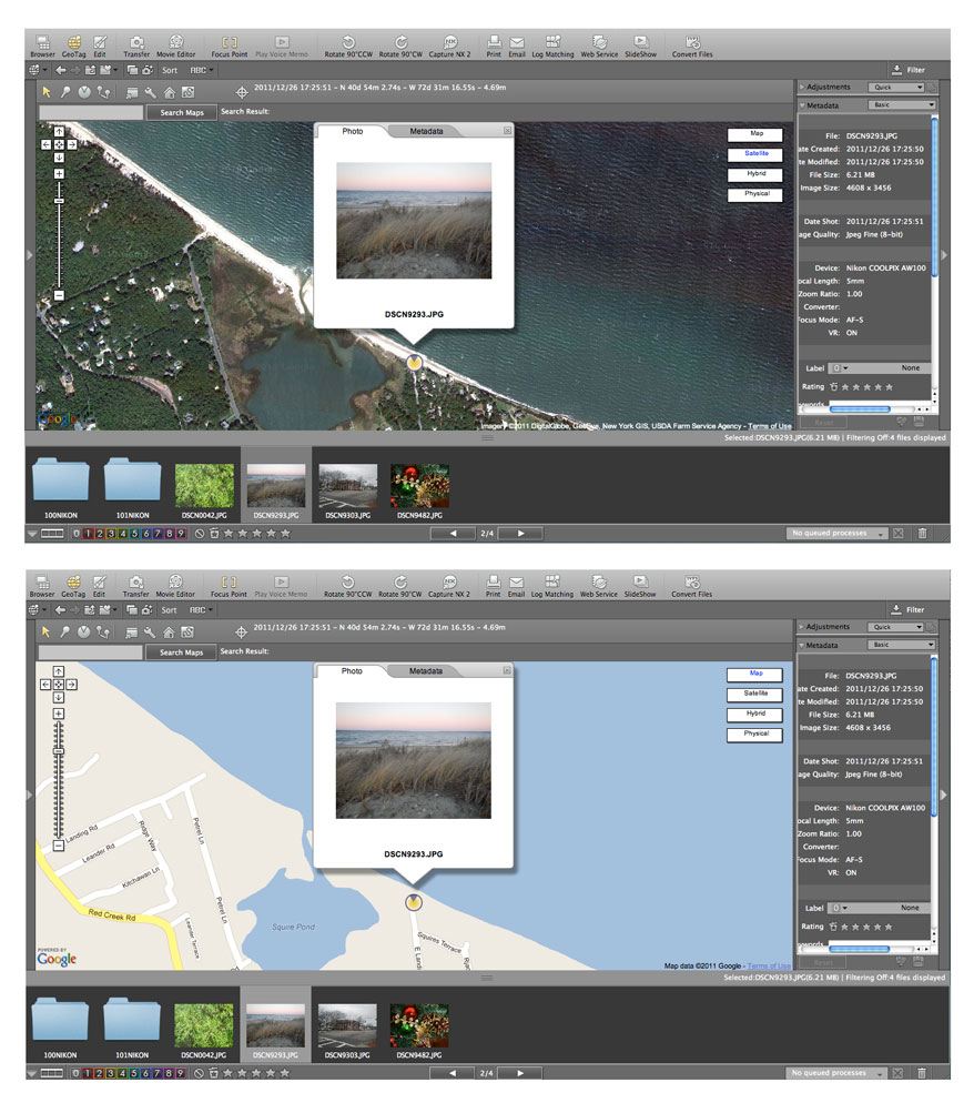
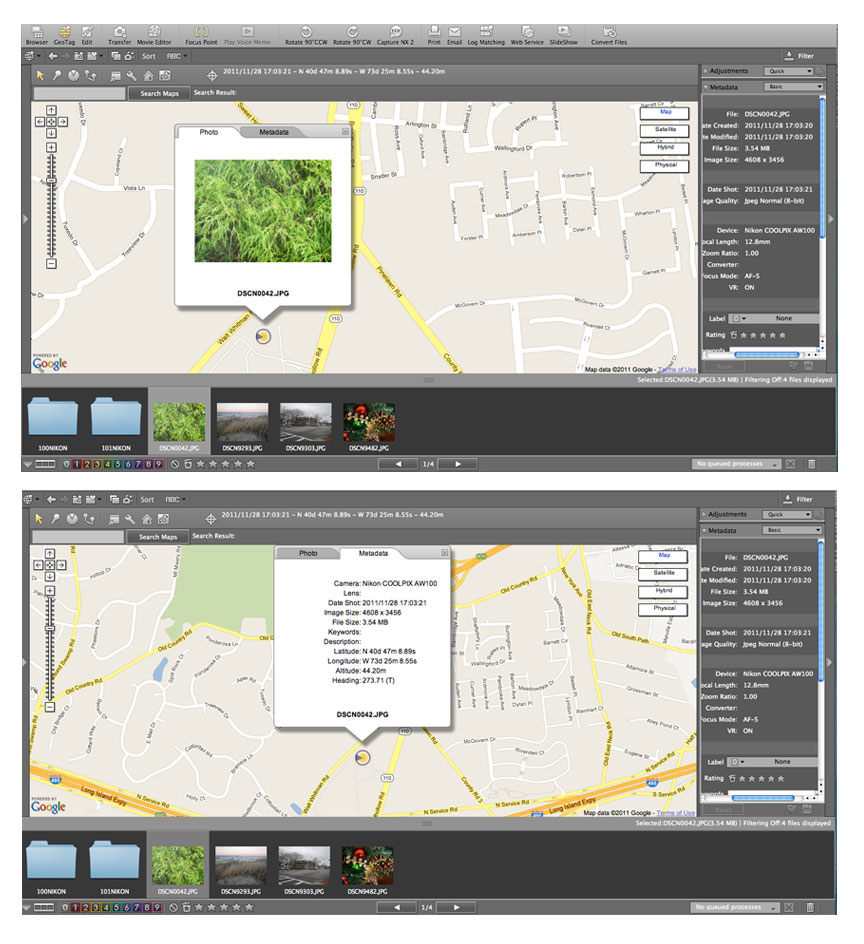
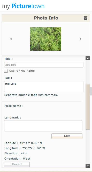
When you view images or video files that have GPS data, in Nikon View NX2 software, an icon of a globe appears beneath the thumbnail. View NX2 lets you view the thumbnails their relative position on the map; which can be viewed as a drawn map, satellite view, hybrid satellite view/map and by terrain. You can view the position data on a map within the software as well as on Nikon's Image Space (formerly My Picturetown) photo sharing site or Google Earth™; or if you have a Mac computer, with Apple’s iPhoto software.
In addition to Image Space, the free Image Space app, for the iPhone®/iPad® and Android™ smartphones and tablets, also lets you view the GPS tagged images on a map.
Read more about the technology behind Nikon's COOLPIX GPS and Maps functions.

